#1217. Backyard Gems: On the Road Again (Finally)!
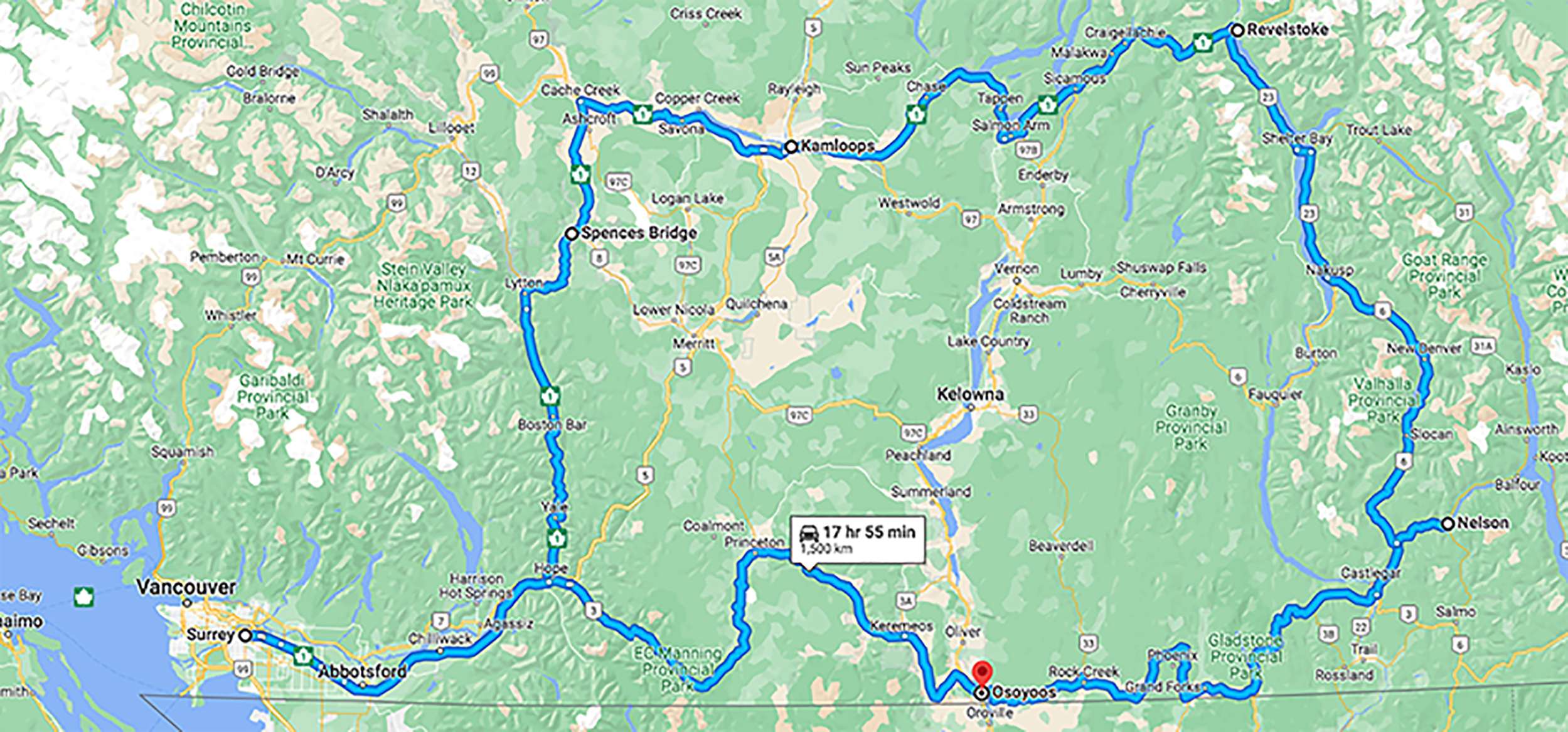
Yes … it’s been a while! The COVID clouds have parted and it’s been two years since the “6 pack” hit the road into the hinterlands cameras in hand. After a month of planning and discussion we took to the road on May 27 for 12 days exploring south eastern BC. All told with side trips and backroads about 2000 mile of driving. There’s far too much to cover in one post, so this is going to be in at least two instalments.
And whoopee! I have a new toy to show off … I had my old and much loved Fuji X-T1 converted to 850nm Infrared and the two most important lenses in my kit work just fine with it … with some limitations. The 10-24mm works fine across its range but the available apertures get larger as you zoom out. At 24mm (36mm full frame) things are good to about f8. At 10mm (15mm in full frame) anything smaller than f4 begins to develop a hotspot in the center of the image and gets progressively worse as I stop down. But hey, 15mm at f4 means depth of field from sometime last week all the way to the Andromeda galaxy. This instalment is all about shooting in infrared and there was plenty of opportunity for that.
Part 1 – The Joys of Infrared
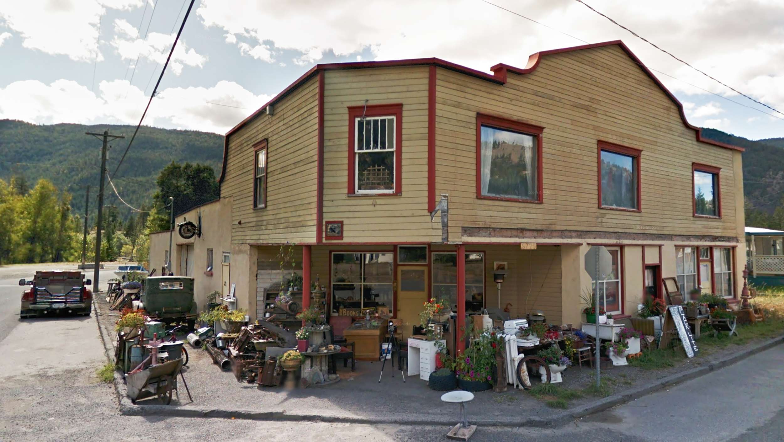
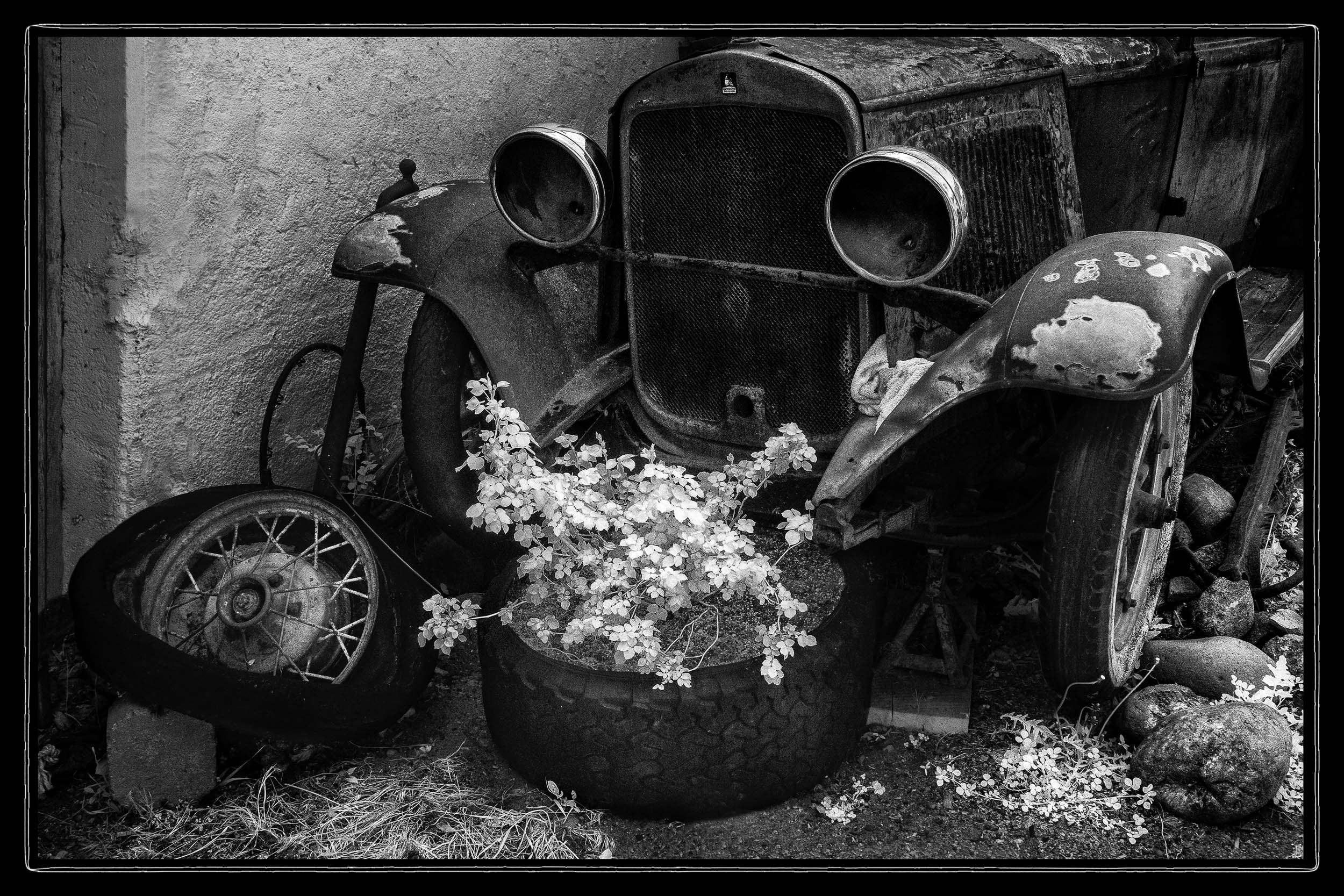
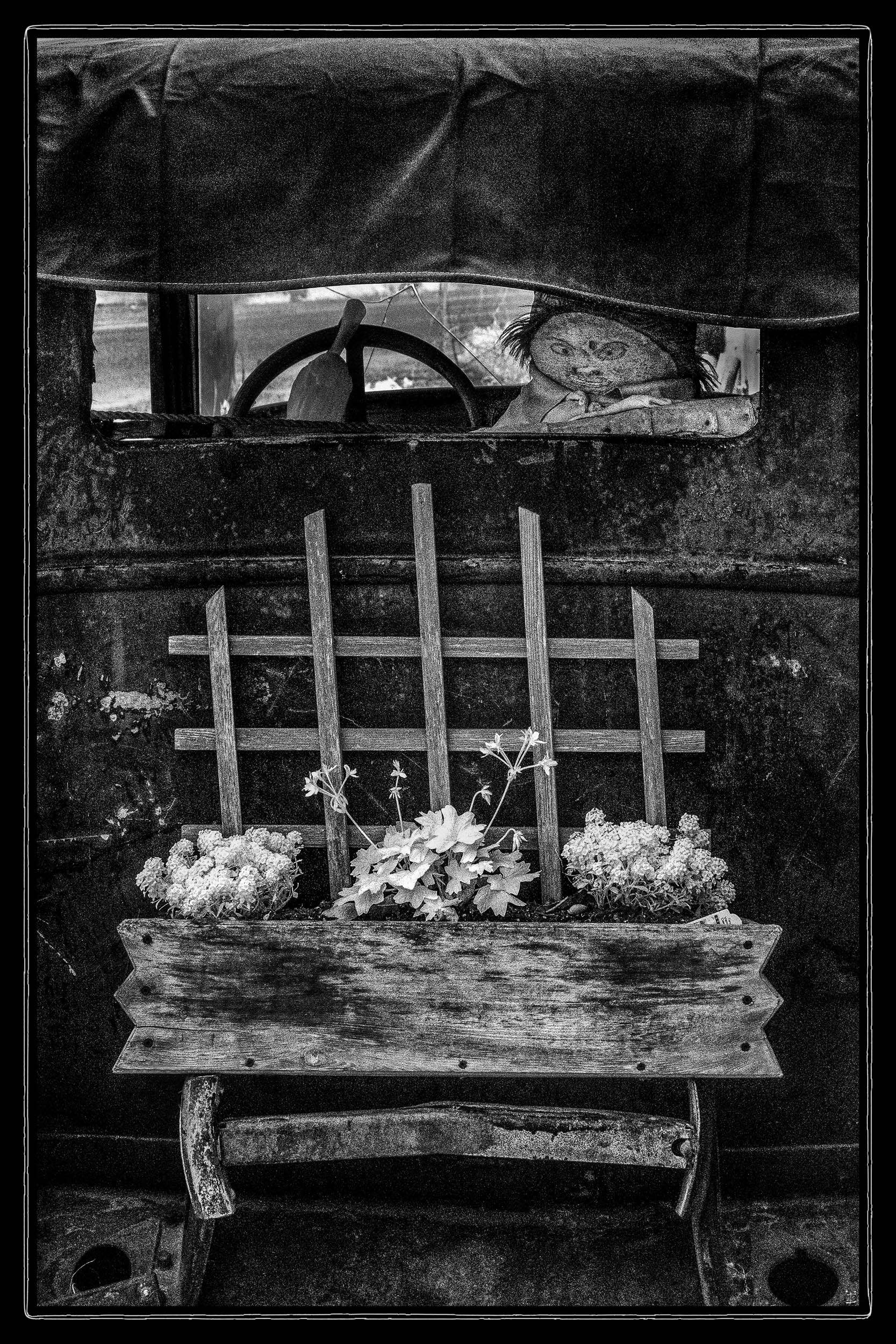
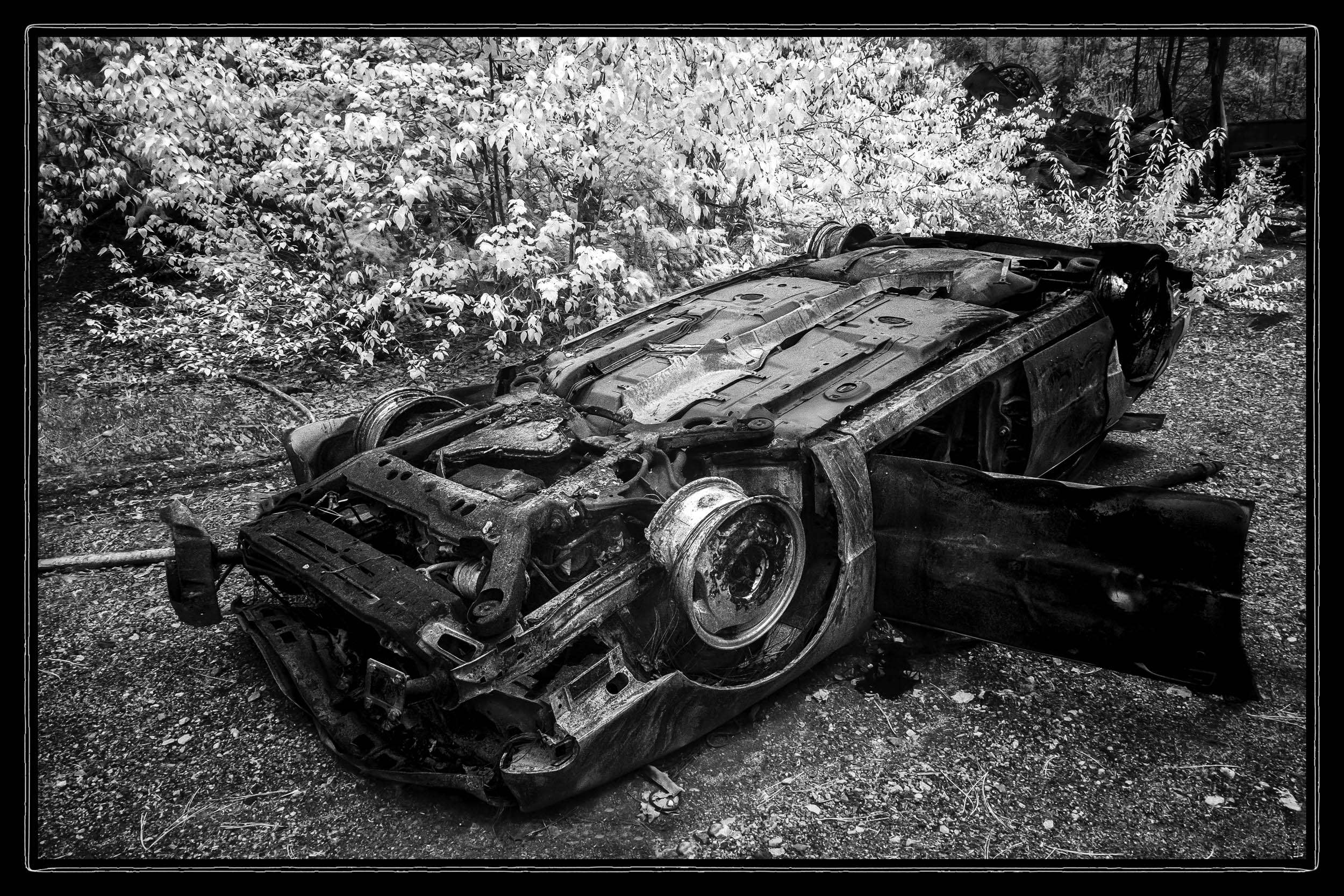
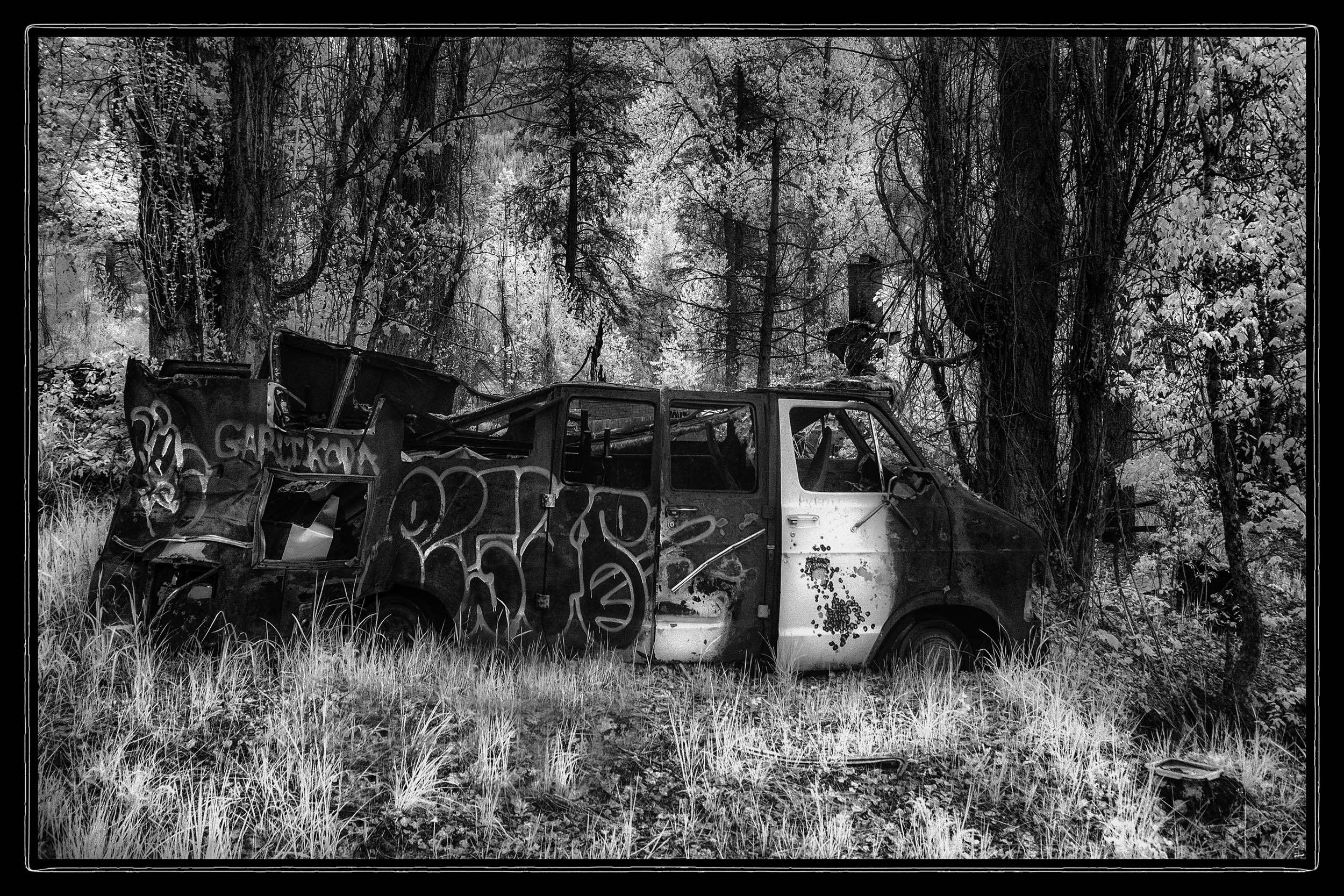
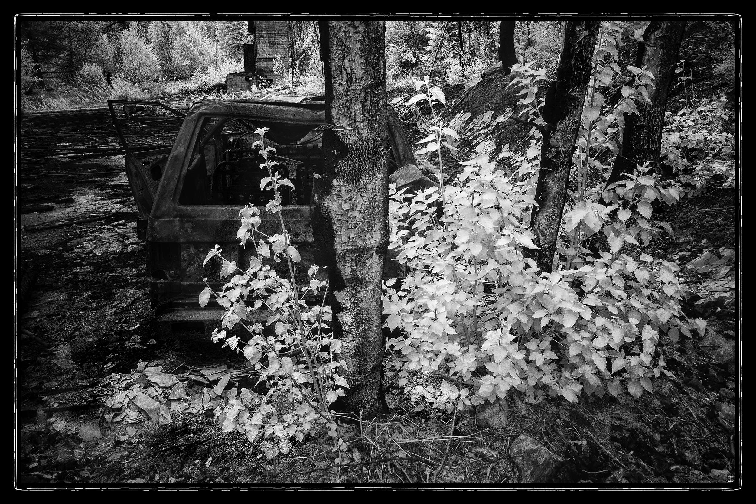
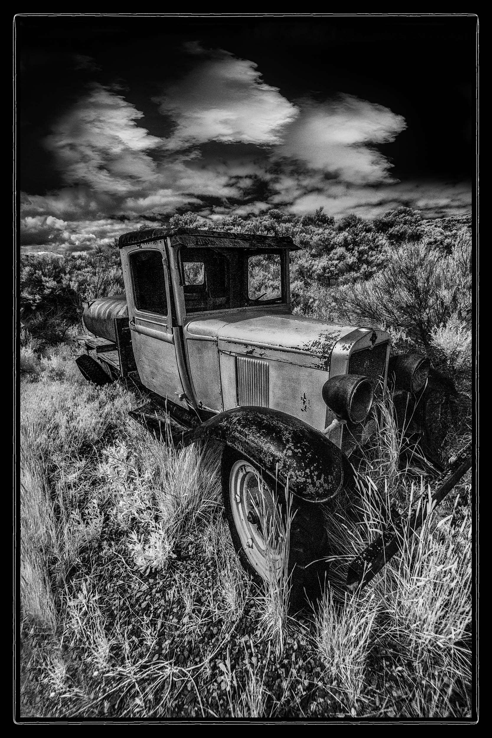
The first stop on the outbound route east was the town of Hedley on the way to Osoyoos our first stopover. Hedley (pop.242) is an old Nickel mining town dating back to 1870. The attraction for our stop was a couple of old cars in a field next to the highway that Bob and I had photographed a few years ago. But this time we ventured into the town and discovered The Old Trading Post, a treasure trove of art and artefacts; more on that in a later instalment. The cars in the field turned out to be … well … just cars in a field. But there was one old beauty permanently parked next to the building with some appropriately whimsical window dressing and perfect light for infrared.
Next up the highway was another little town called Greenwood (pop.702). Greenwood was a copper mining and smelting center from 1886 to 1919 when the smelter closed for good due to a collapse in the copper market. Dave has a friend in Greenwood (he seems to know someone just about everywhere in BC) who knows the mayor Barry Knoll and through her good offices he had agreed to show us some of the hidden secrets of the area. The old smelter is still there just up a hill on the north side of the town, but access is restricted. Instead Mayor Barry suggested a collection of abandoned miners cabins (YES!!!) back in the hills south of town. A bit of a drive down some very narrow and sometimes rough dirt roads, but that’s to be expected considering the place has been abandoned for over a century.
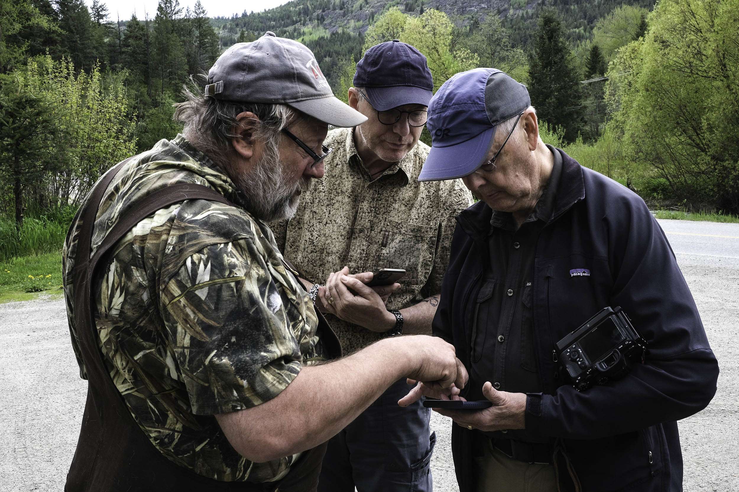
Mayor Barry, Grant and Bob sorting out directions
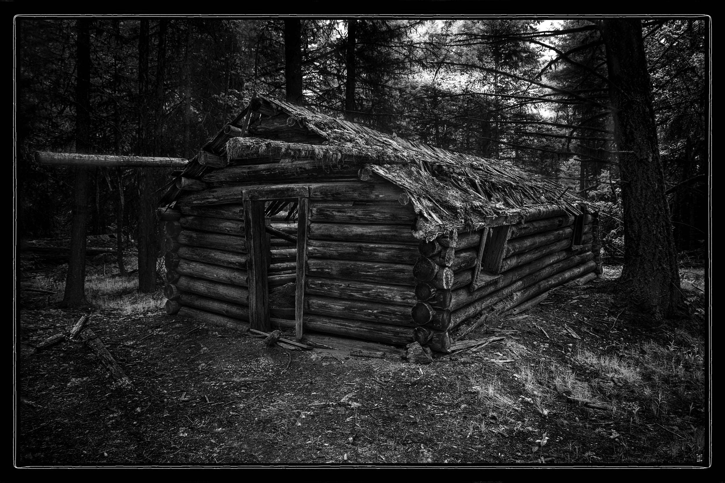
This forested hillside is littered with a dozen or so log cabins in various states of decrepitude including collapse and, in some cases, just foundations. But underfoot, the mountainside is honeycombed with about 70km of abandoned mining tunnels. Equally startling is the small fortune in recoverable timber in these old structures. Hopefully no one decides to harvest them for the foreseeable future.
After an overnight in Osoyoos we headed off to Nelson (pop.11,106) tucked away in the Selkirk Mountains on the West Arm of Kootenay Lake. Known as "The Queen City", for its impressive collection of restored heritage buildings from its glory days as a regional gold and silver mining hub. But the real attraction is its murals, graffiti and the abandoned mines and ghost towns littering the area.
South of Nelson on Hwy 6 is the town of Salmo, another former mining boom town. To the east of Salmo off Hwy 3 and up a dirt road, next to the rushing roaring torrent of Sheep Creek, are the abandoned remains of the Sheep Creek Mine. The name “Sheep Creek Mine” kept ringing bells in my brain and it finally twigged why. Back before the dawn of time when I moved to the west coast I shared a bachelor pad with two teachers Rod and Daryl. Rod was an Engineer who taught High School math and Daryl was a Geologist who taught Elementary School. Both worked at their professions in the summer months when not teaching. Daryl used to be the former Underground Geologist for the Sheep Creek Mine and, after he took up teaching, spent the summers working for them. It was just a little eerie poking through the remains of where he used to work half a century ago.
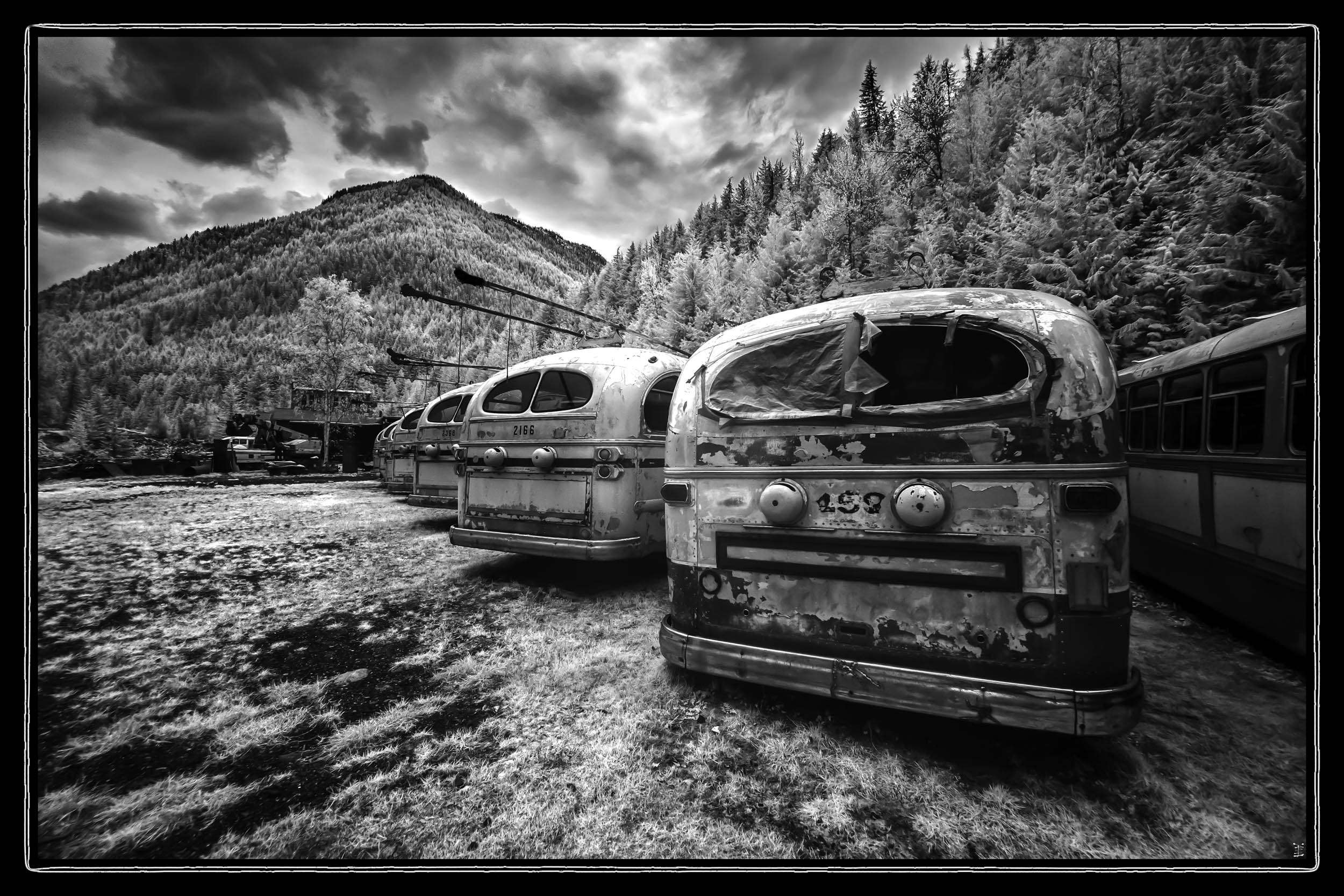
To the Northwest of Nelson are the remains of Sandon (pop.6). Take Hwy 31 north up the west side of Kootenay Lake into Kaslo and turn west onto Hwy 31A for 38.5km; turn left onto Sandon Road and follow it into the old town site at the junction of Sandon and Carpenter creeks. Once a bustling silver mining town with a population of 5000 a series of natural disasters and economic downturns eventually destroyed the town physically and economically. Today it attracts over 60,000 visitors a year. One of the main attractions is the collection of decommissioned electric trolly buses from the 1960s and 70s and the 120+ years old power station – the oldest continuously operating electrical generating station in Western Canada.
The northern end on our route was Revelstoke (pop. 8,275). From Nelson, take Hwy.6 West and then North at Castlegar. Further North, Hwy 6 becomes Hwy 23 on the way to Galina Bay to catch the ferry across Upper Arrow Lake to Shelter Bay where Hwy 23 continues North to Revelstoke on the western shore of the Columbia River (yes; the same Columbia River of Columbia Gorge fame).
Revelstoke dates to the 1880s when the Canadian Pacific Railway (CPR) was built across the country and through the area. The last spike joining the eastern and western sections of the line was driven just east of Revelstoke and the town’s Railway Museum is a tribute to that past and its continuing ties to the railway that connects the nation. Still, like the majority of communities in the rugged mountain country of eastern BC mining and lumber were important early industries. Tourism is now a central part of the local economy and the town sits on the western edge of the worlds largest deep powder skiing area made up of 20k square kilometers of contiguous mountain ranges – the Kootenay, Selkirk, Monashee and Purcells. The skiing and outdoor Revelstoke Mountain Resort was the first resort in the world to offer lift, cat, heli and backcountry skiing from one village base and is the hub of the local winter sport economy. But, like Nelson, the real photographic attraction is the abundance of murals, wall art and graffiti gracing its laneways – not suitable for IR, but great for the second instalment in colour. And some thoughtful planner scheduled the annual local car show for right outside our front door … so thoughtful those Revelstokers. Still, the landscape outside of town does have its attractions.
![]()
A friendly and kind waitress tipped us off about this location out past the airport. Normally this would be a shallow lake from the overflow from the dam just north of the town. But the chilly spring most of BC was suffering through slowed the slow melt in the surrounding peaks and the flats remain a spring marsh – perfect for IR.
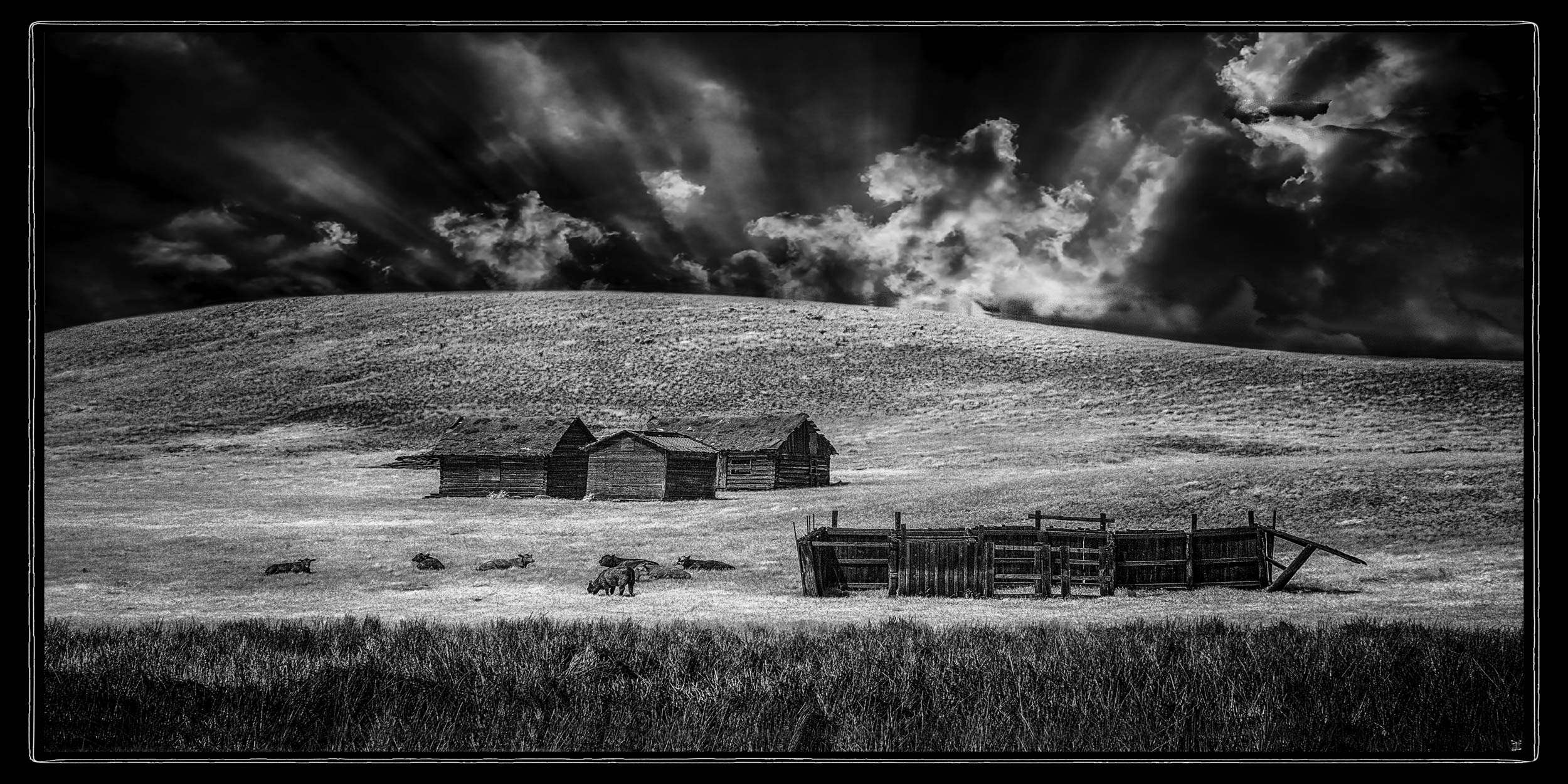
We’d photographed this location from the junction of a side road on the way out with ho-hum results and moved on. On the reverse trip it was as if someone had said “OK, they’re gone now. Lets lay it all out and see if they notice.” Notice we did, for about 15 minutes of framing, chimping and scrambling about to get just the right composition. I’m happy. Your mileage may vary.
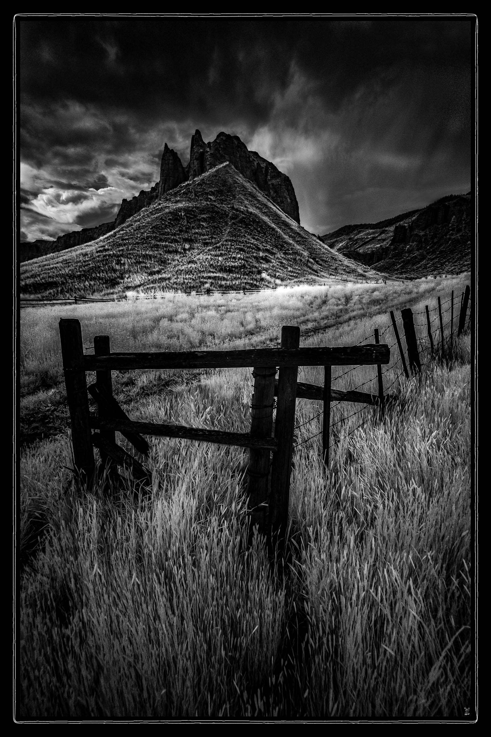
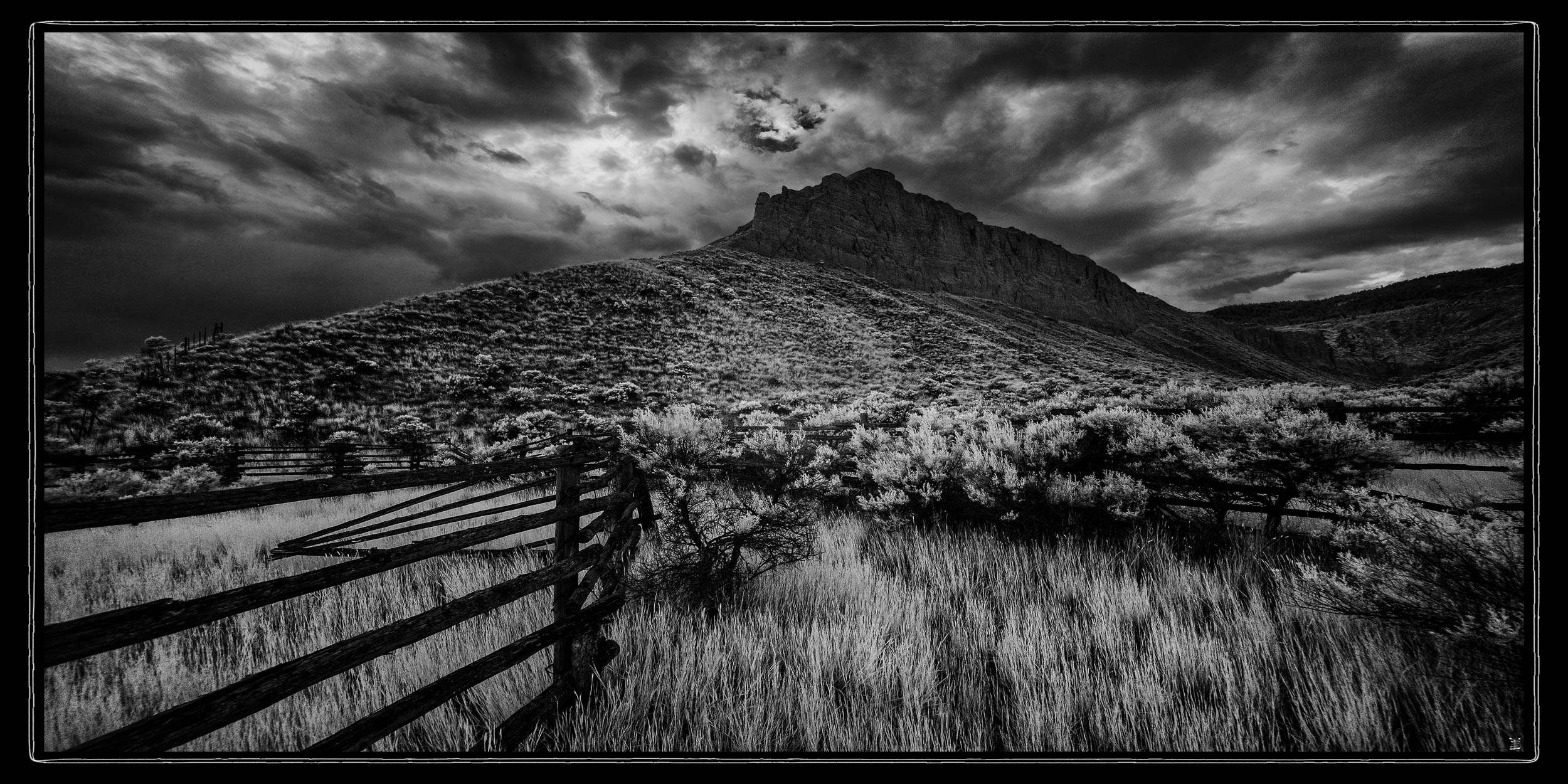
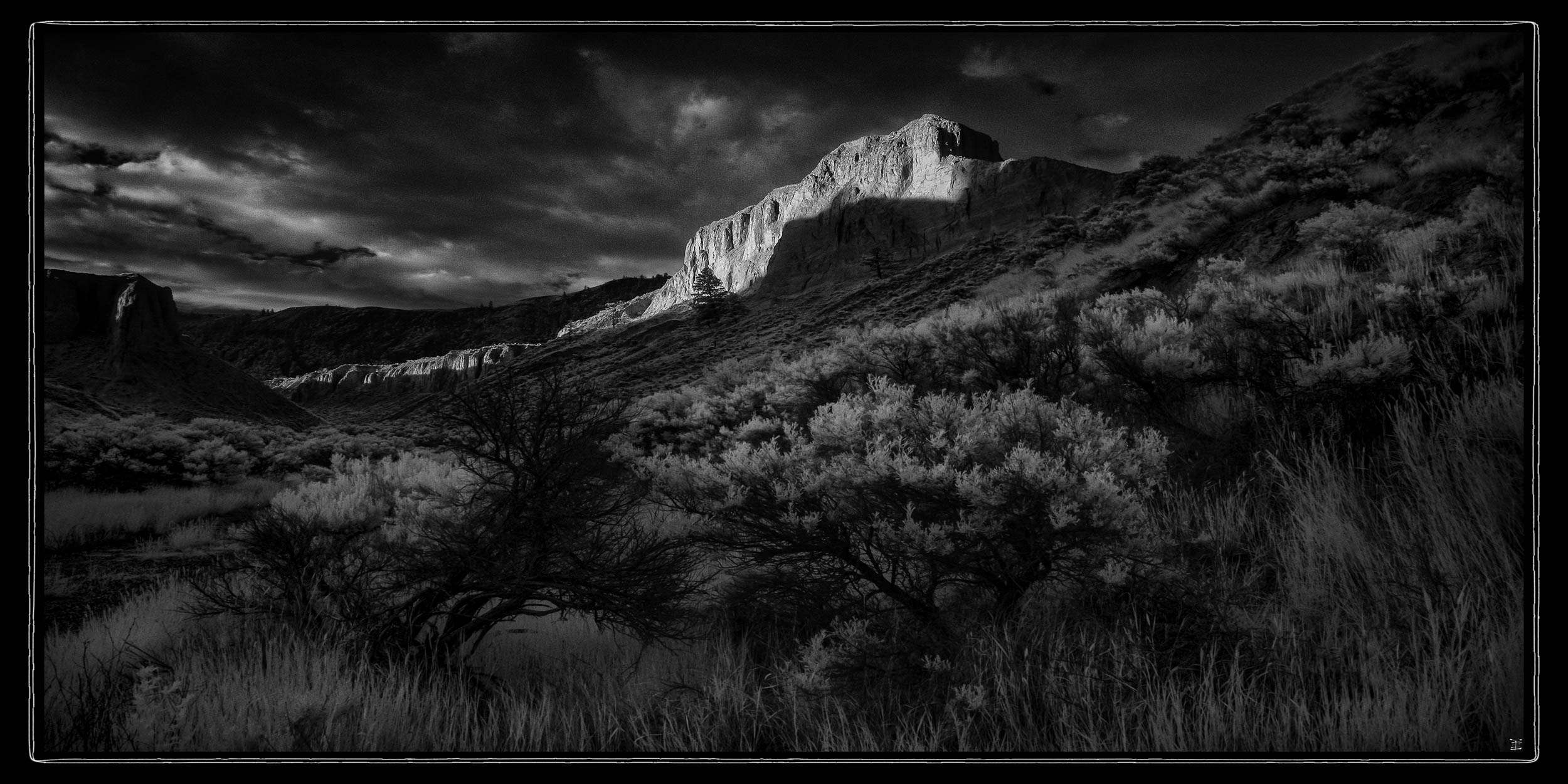
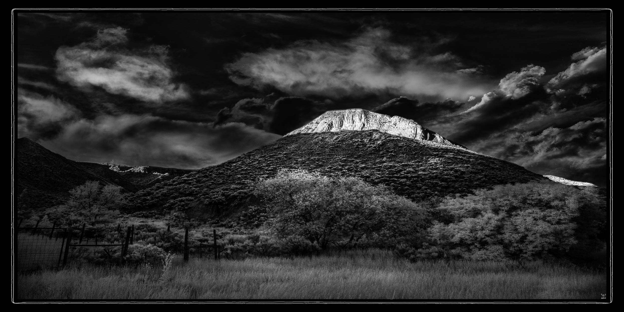
From Revelstoke our route headed west to the city of Kamloops (pop. 98,000) at the junction of the Thompson and the North Thompson and South Thompson rivers. The city dates to 1812 when the Pacific Fur Company set up a trading post to trade with the Schwepmec First Nations people. The name Kamloops aptly translates as “point between the rivers” in the Schwepmec language. What we really came for was the “hoodoos” a series of clay spires along the north side of the South Thompson river east of town. Take Hwy 5 north out of town and turn right at Shuswap Road. About a mile east (1.6km) they begin on the left side of the highway. They did not disappoint.
We timed our excursion for mid evening to catch the sunlight from the west along the face of the spires. The route along that side of the river is a two lane road with few places to pull over, but we found four strategic locations with off road space and fabulous views of the spires. The first evening was a bit disappointing with clouds along the western horizon but not a complete loss. The second evening was perfect with light leaking under the clouds to the west and just touching the peaks.
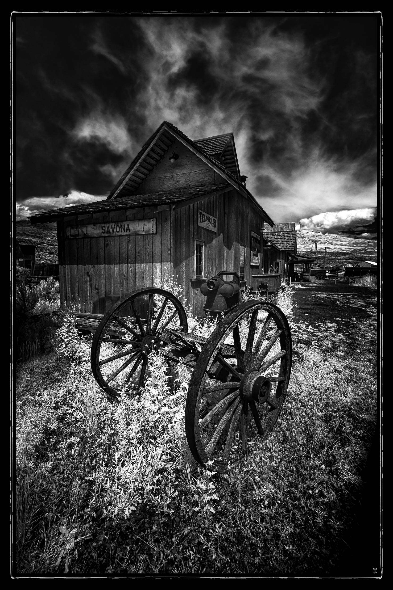
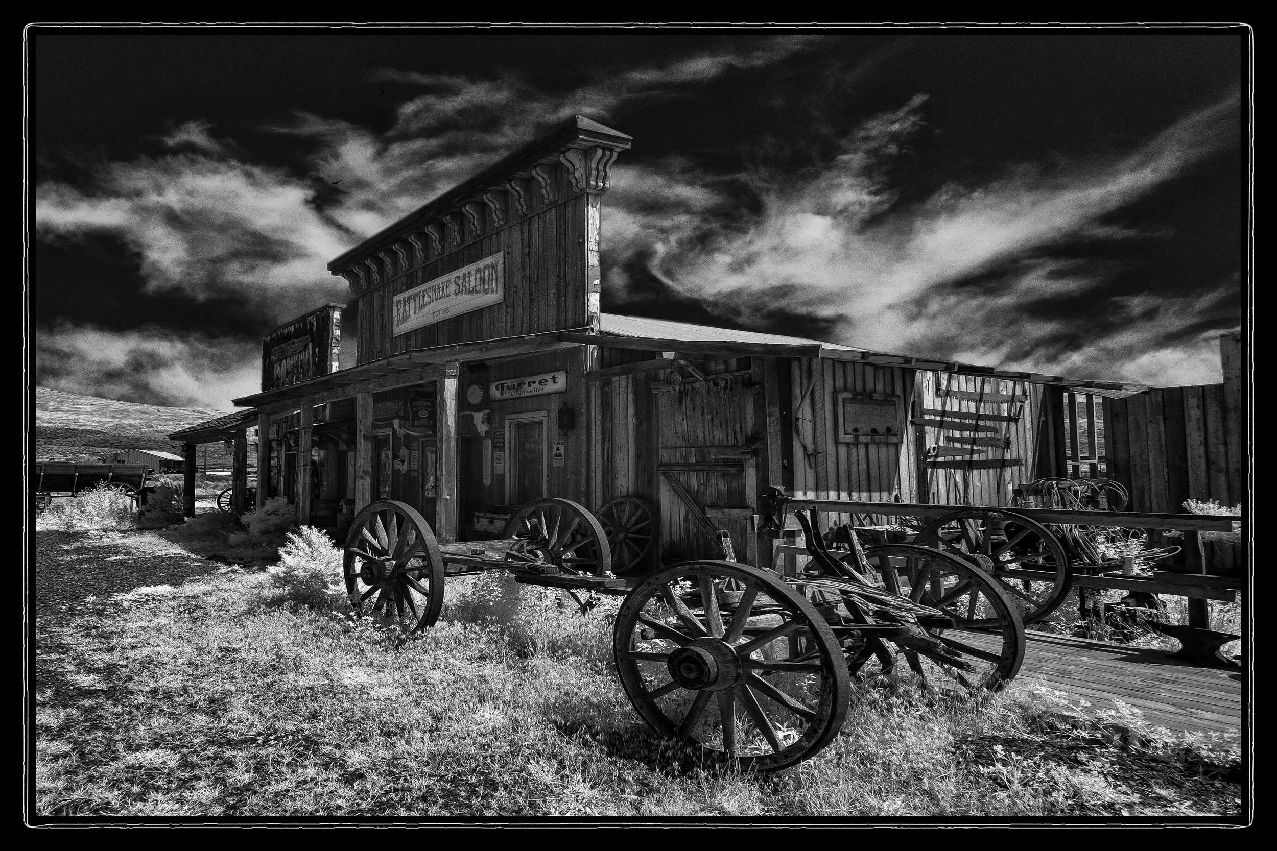
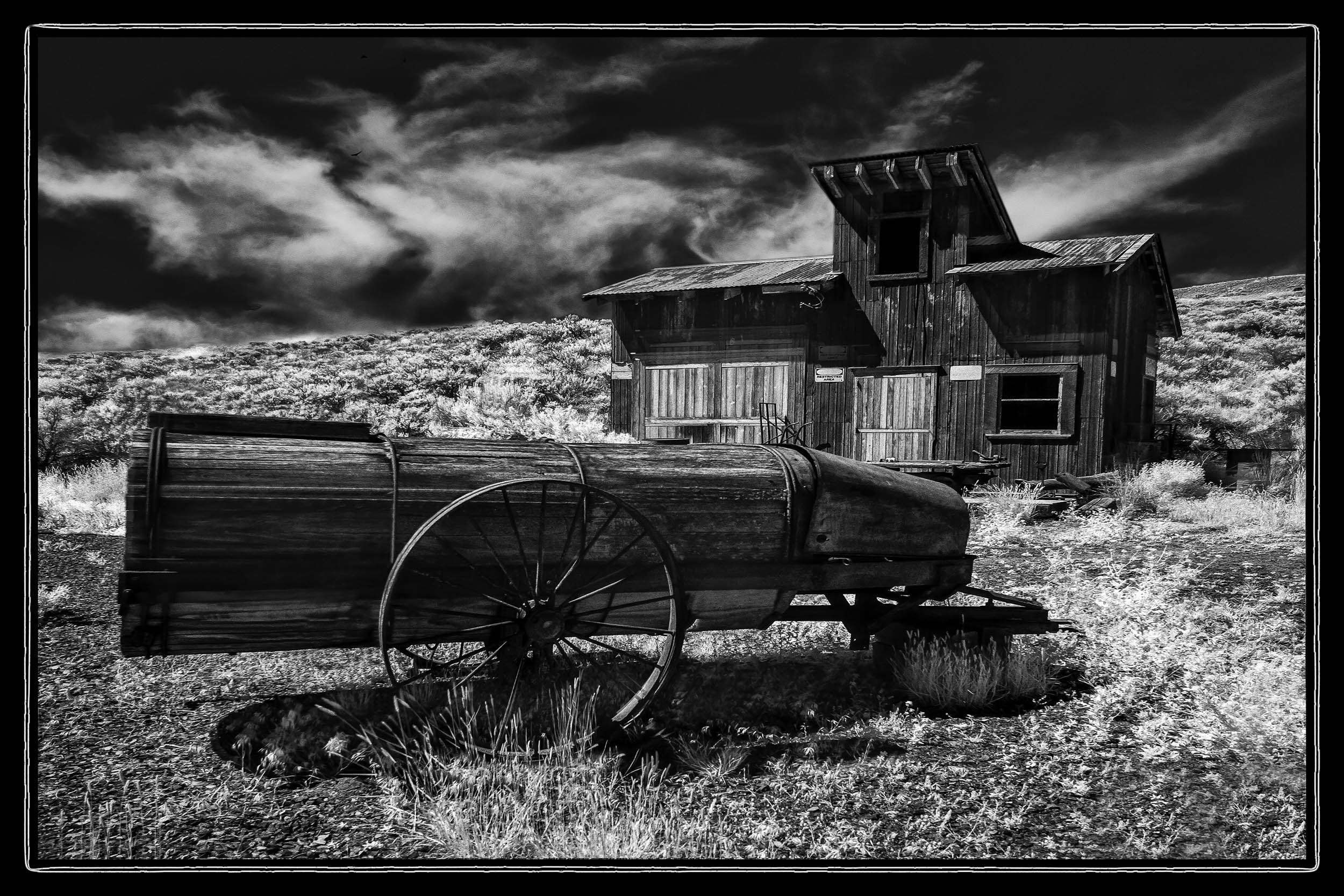
Two nights in Kamloops was all the schedule allowed before we hit the road for home. But the fun was not over. About 60km west of Kamloops on the Trans Canada Hwy (Hwy 1) just wet of Savona is Deadman Ranch, a recreated ghost town of assorted buildings and artifacts collected from BC and the western US and reassembled on the site. They weren’t fully open, but the owner Matt Sandvoss is a friendly, gregarious fellow who’s delights in talking about and showing off his brainchild and let us in for a happy hour and a half of snapping away in perfect IR conditions.
On the southern leg of the route home we also discovered Kim’s place, a small collection of old and antique cars owned by another friendly gregarious fellow and there’s always the Vulture Garage in Spences Bridge, another favourite stop of ours. But both those are in colour.
More to come. Stay tuned.