#1398. Tasmanian travelogue
Contributor John Shingleton, lives in Terrigal, New South Wales. In this article, he relates a trip to Tasmania, on Australia's southmost tip.
Although I have been a keen photographer for over sixty years, I have rarely taken a landscape photograph which pleased me. There have been some rare exceptions and one, which was really a seascape, did win a prize in a competition a few years ago, but that was an outlier. On a recent visit to Tasmania, I renewed my acquaintance with the art of landscape photography.
I realised early on from my personal efforts that good landscape and wilderness photos require real commitment and dedication in the photographer. They have to be prepared to go out in all weathers, at unsociable hours. They have to walk and climb long distances to reach the magic vantage points, and then wait for hours or even days for the perfect light and weather. Fortunately, there are many who are prepared and able to do this.
Formidable reputation
One such photographer was Peter Dombrovskis. Peter was born to Latvian parents in a refugee camp in Germany in 1945. His father had died in the war, and he migrated to Australia with his mother in 1950. Luckily, they settled in Hobart, Tasmania. He took up photography at an early age and was encouraged by his mother and mentored by another Tasmania-based wilderness photographer, Olgas Truchanas. In a few years, Peter had built a formidable reputation and was publishing his work in books and calendars. Sadly, his life was cut short in 1996 when he died while photographing in the South-West Wilderness area.
For me, Peter is up there with the very best wilderness landscape photographers. Quoting from Wikipedia:
“His most famous photograph is Morning Mist, Rock Island Bend, Franklin River, The photograph portrayed a section of the Franklin River which was to be submerged by the proposed Franklin Dam, and it highlighted the visual appeal of the Franklin River during the contentious ‘No Dams’ campaign of 1982. In 1983, Dombrovskis published a book, Wild Rivers, co-authored with Bob Brown, which exemplified his skill in photographing the Gordon and Franklin rivers.”
Not only did Peter’s superb image significantly contribute to the public awareness of the stunning beauty of the Gordon/Franklin Rivers area, it led to the abandonment of the hydro dams project. His pictures of the region generally are recognised as playing a major role in the South West Wilderness area of Tasmania being recognised as a World Heritage by UNESCO.
Heavy going
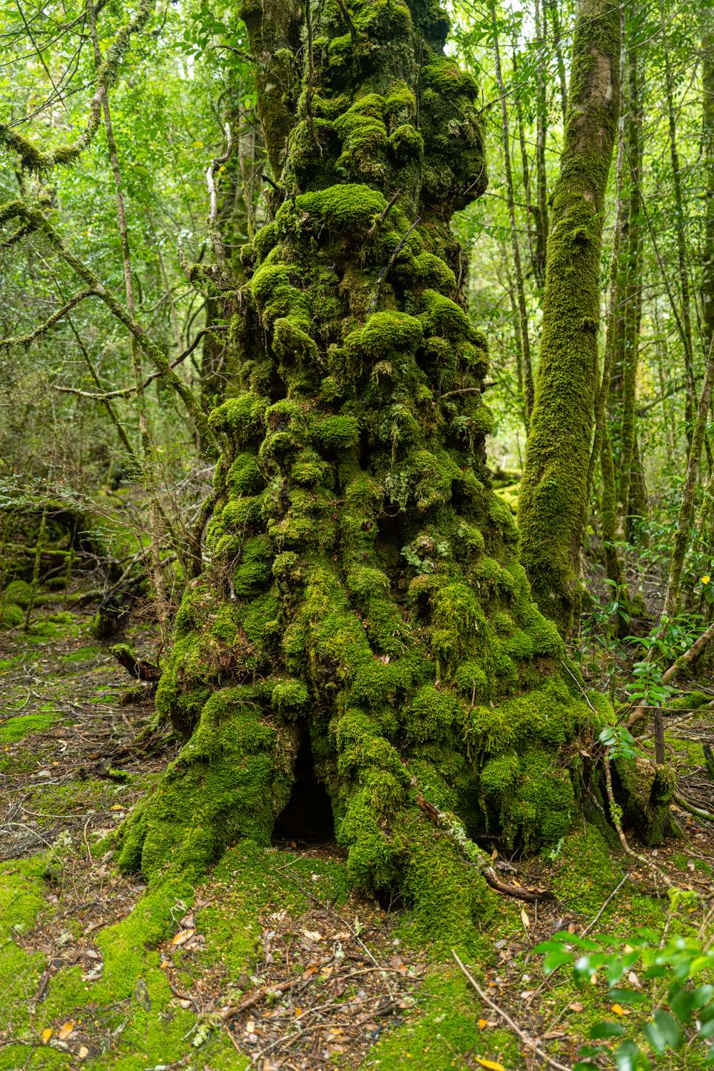
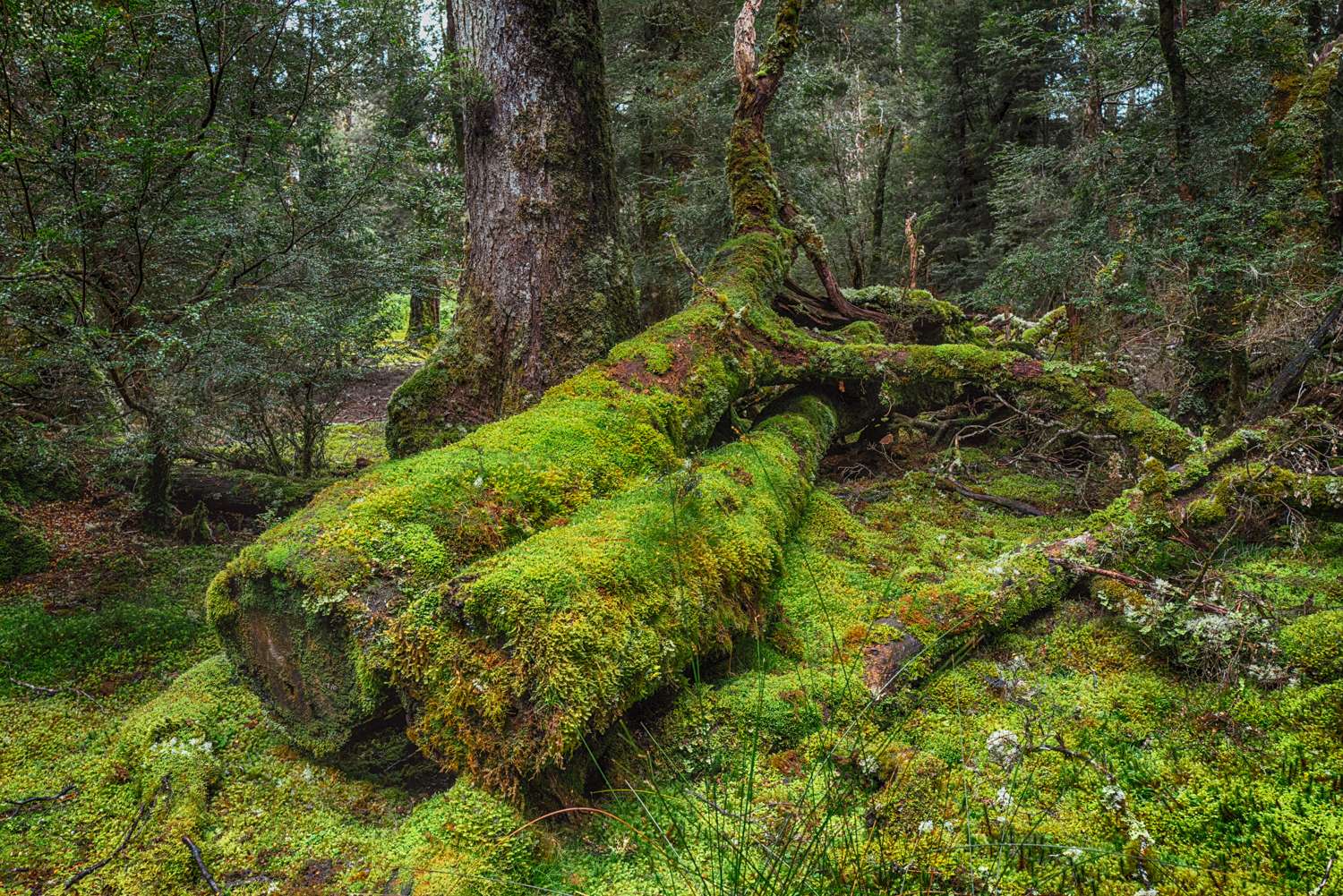
Peter started his photography with a Zeiss 35mm camera, and he moved onto a medium-format Rolleiflex SL66 in 1974 and then a 5×4 Linhof Technika two years later. The majority of his iconic photos were taken on sheet colour transparency film, using the Linhof. He would have used a tripod with the Linhof so it would have been heavy moving on foot through the wilderness with his camera gear and his camping equipment. The rainforest areas are always wet, and the forest floor is deep in moss, fungi, and tree debris as some tree species live for thousands of years.
Fortunately, Peter’s photos have been preserved in the collection of the National Library of Australia and can be viewed online here.
Furthermore, the National Library of Australia has published a superb big, high quality, hardcover book of 177 of his photos which is available through Amazon Australia (amazon.com.au) and Booktopia (booktopia.com.au) for just A$30 (US$20). A great bargain.
As you view Peter’s stunning images, it’s important to realise that they are big colour transparencies and what you are seeing is what he composed and took. No cropping. No post-processing. Every image is carefully crafted. So different to how most photographers work today.
No deterrent
I realised years ago that there was zero chance of my ever taking wilderness photos of Peter’s standard. It’s easy for me to say that I did not have the opportunity to access the wilderness areas he did, but the reality is that I also do not have the eye, the patience, or the fitness. However, none of this has deterred me from taking a camera with me when I have visited Tasmania over the years.
The most spectacular wilderness areas of Tasmania are on the western side of the island, but the east also has very scenic areas such as the Freycinet Peninsula which my partner and I visited in December 2022.
That trip two years ago was so enjoyable that we decided to visit the large western wilderness areas on a future adventure. In 2022, we took the Mini on the overnight ferry from Geelong, west of Melbourne, to Davenport on the north coast of Tasmania. The drive down to Geelong from home (in Terrigal NSW) takes ten hours, almost wholly on motorway, through rather tedious scenery. And the overnight ferry crossing can be very rough, as well as expensive, even for a Mini.
Flight to the south
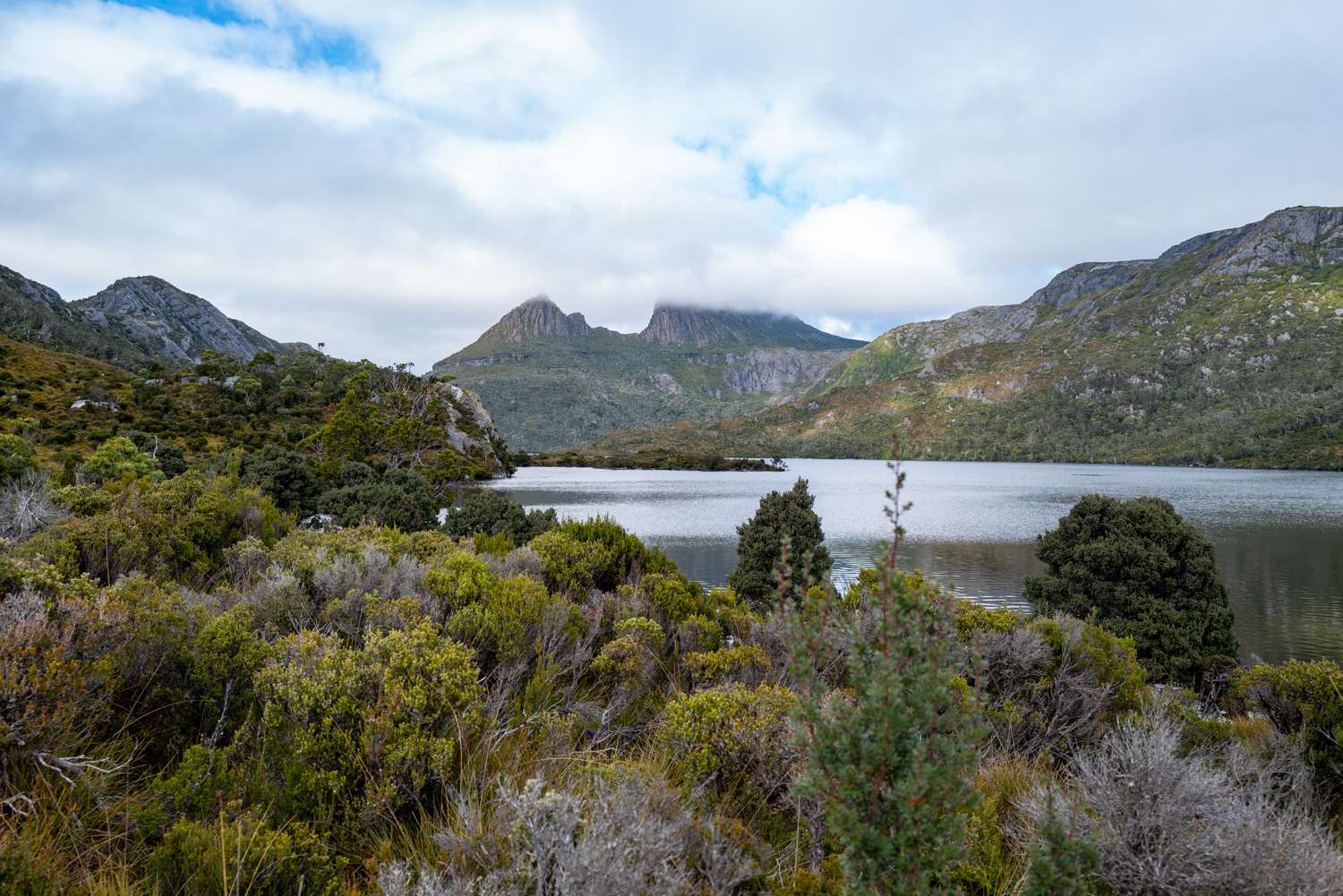
So in April we drove down to Sydney Airport and then flew to Launceston in Tasmania. Simple and with no risk of seasickness. From there, we drove in a rental SUV to Cradle Mountain Lodge in the Cradle Mountain-Lake St Clair National Park — part of the World Heritage Wilderness Area.
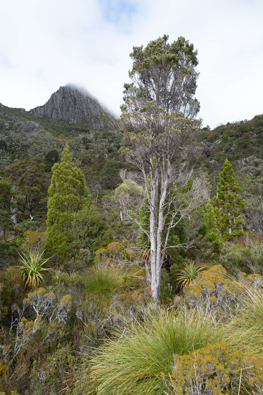
Originally, this trip had been planned for late November last year but was postponed. November would have been early summer, but April is early winter, and it was getting colder, particularly overnight. The weather is very changeable. As it says in the Cradle Mountain Visitor’s Centre, “The weather — beautiful one minute and deadly the next”. It is the wettest place in Australia, with rain on average 240 days every year.
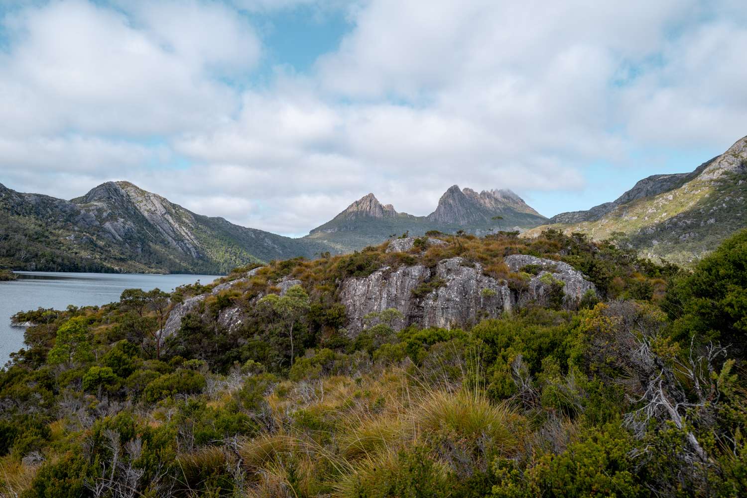
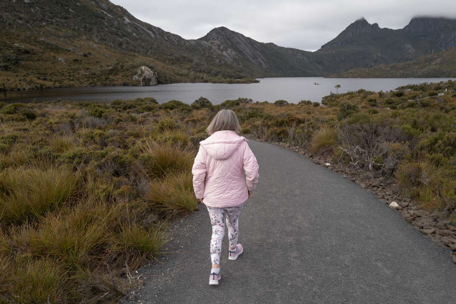
I visited Cradle Mountain with my family way back in 1988. Then it was popular, but not nearly as popular as it is today. Now, tens of thousands of visitors come to the park every year. It was reasonably busy during our visit, but the infrastructure for visitors is very well-organised. Cars are not permitted in the park during daylight hours. There are car parks by the Visitor’s Centre at the park entrance, and shuttle buses take the visitors on the 15-minute drive down to Dove Lake. It seems to run very smoothly. Mass tourism done well. As soon as we walked away from the scenic ‘hotspots’ by the lake’s edge, the visitor numbers soon thinned down.
On the boardwalks
Back in 1988, some walking tracks were boardwalks, but mostly it was ‘free’ walking on and off the worn trails. Now there are many walks with boardwalks for all or part of their length. Dove Lake is the starting point for the six-day Overland Walk through the South West World Heritage Wilderness Area as well as other shorter walks including the very picturesque Dove Lake circuit which we walked on our second day.
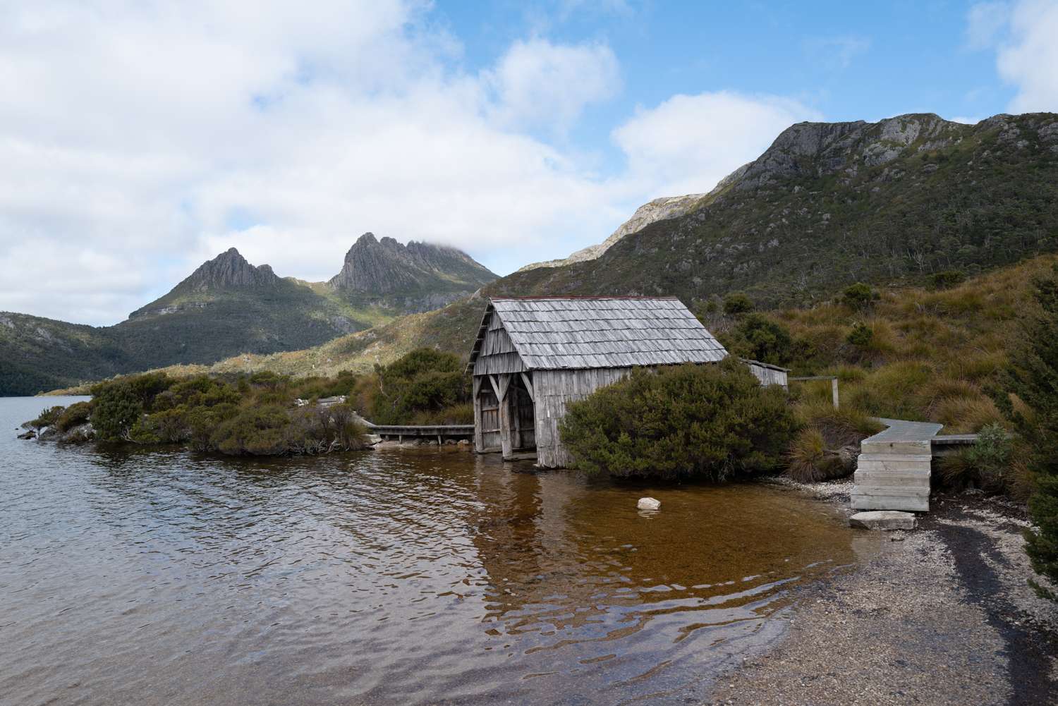
Dove Lake and, in particular, the Boathouse with Cradle Mountain in the distance, must feature in the photos taken by every visitor to the park. It’s very difficult to take an original photo there, so I make no claims as to the originality of my photos of the lake.
The Cradle Mountain Lake St Clair National Park is the most accessible part of the large World Heritage Wilderness area, which is the reason it is so popular with visitors. To go deeper into most of the wilderness, you have to walk in or be taken in by light aircraft. There are almost no roads into or across the area.
I took my Leica Q2 on the trip. Of course, it proved to be almost the ideal travel camera as it and its predecessor, a Q, have done for me over the past seven years. However, there were a few times on this trip that I wished that I had a camera with a longer lens. I could have brought my X Vario, or even my, underused, Lumix S5, but I believe in travelling light, so a bag full of camera gear is never an option for me.
Tripod trials
One item of gear I did wish that I had with me was a tripod to enable longer exposures of running water and in the rainforest when I wanted to maximise depth of field. I do own a superb Manfrotto. It’s a heavyweight model I have owned for many years and probably used about 20 times, most of which were in my very brief and ill fated reacquaintance with film photography and Hasselblad. My son now has the tripod. I hope that he is finding it useful. There is no way I was ever taking it to Tasmania.
Before flying to Tasmania, I visited the local, very well stocked, Camera House store and sized up lightweight, carbon fibre travel tripods. In the end, I decided that while one would, perhaps, be useful for this trip, it was something I could really do without longer term. An unusual decision for me to make. Perhaps wisdom does kick in as one ages.
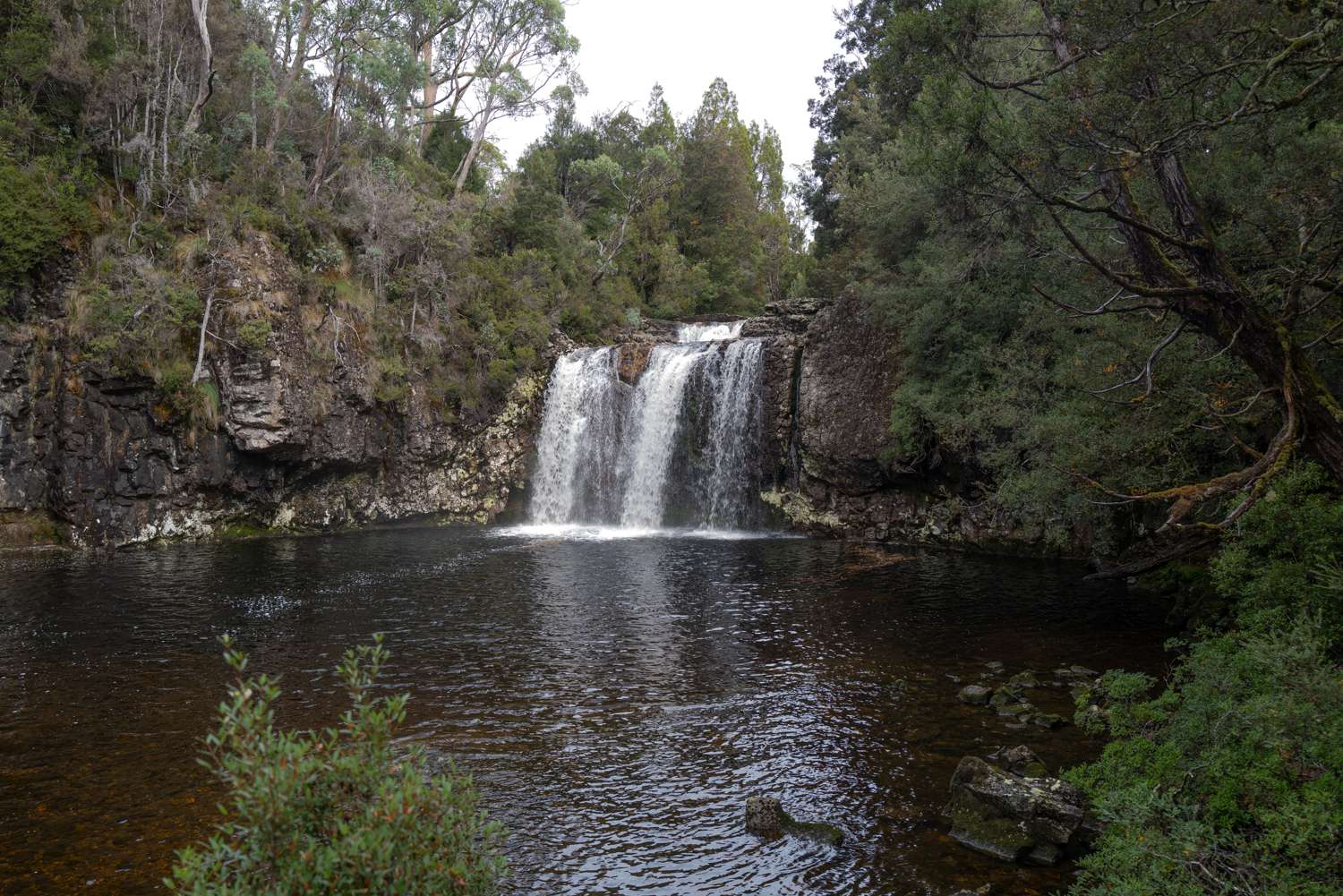
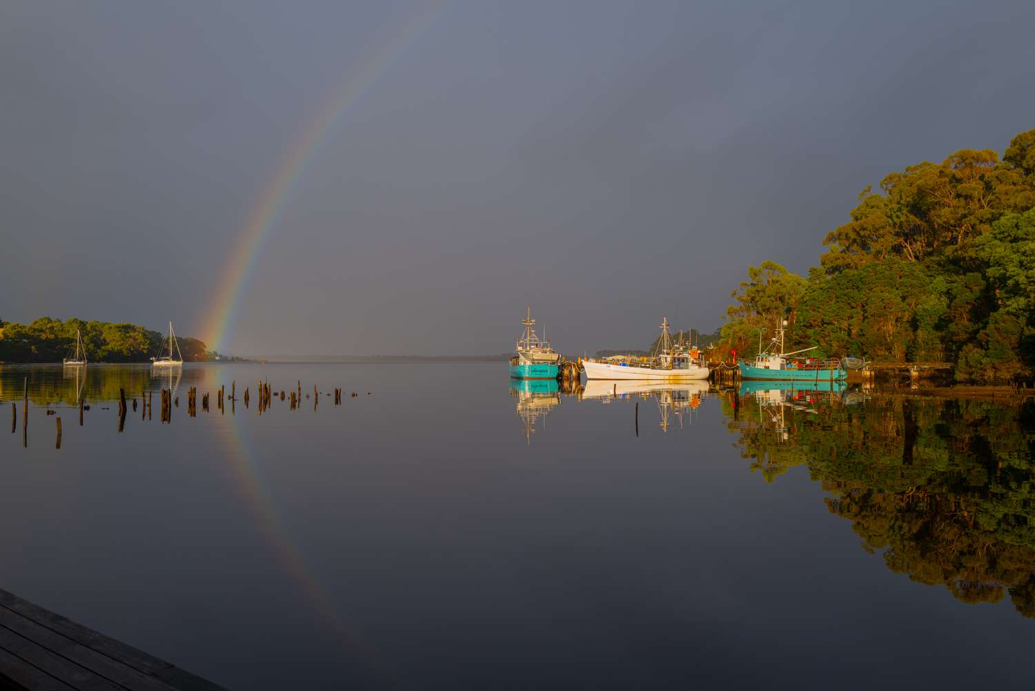
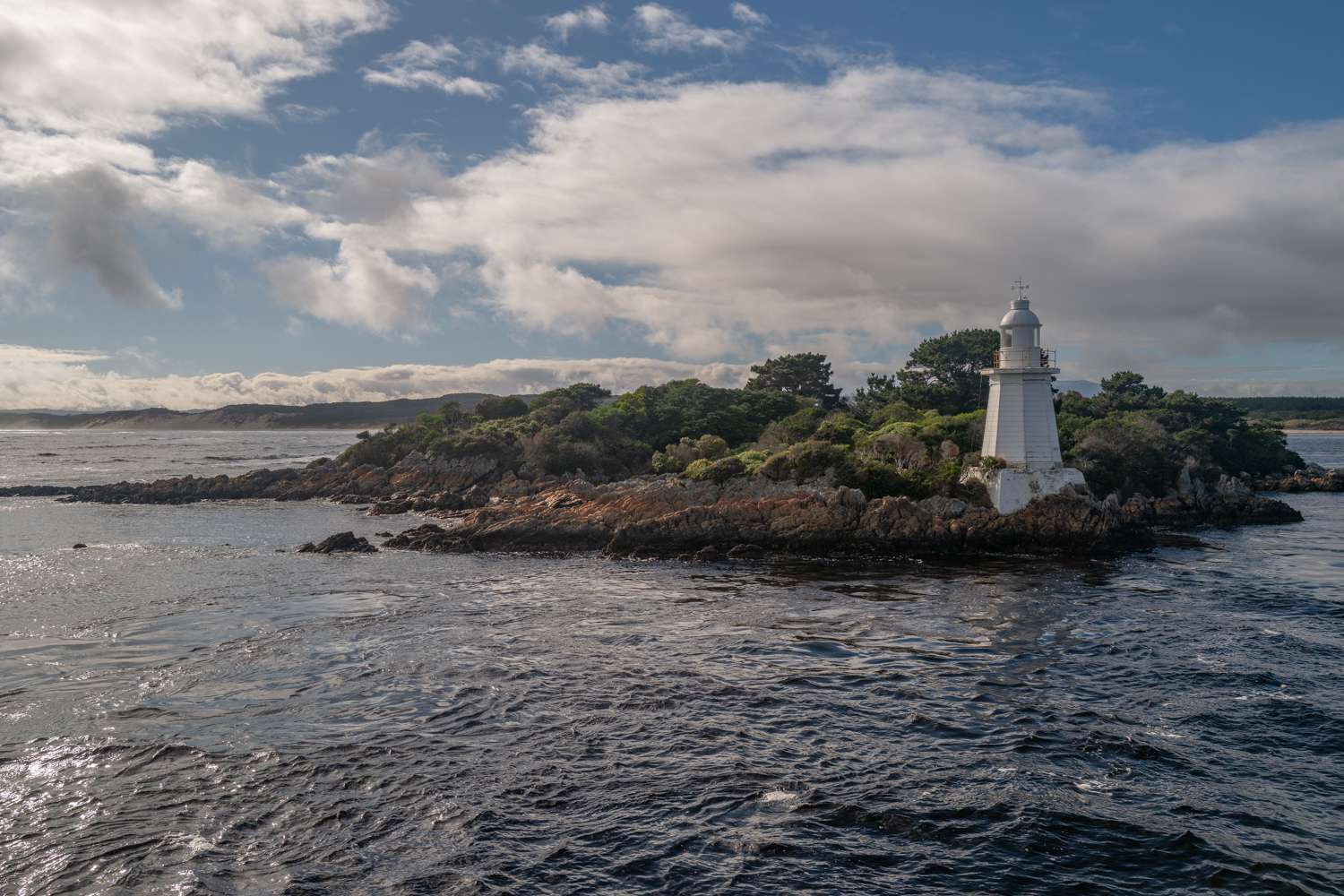
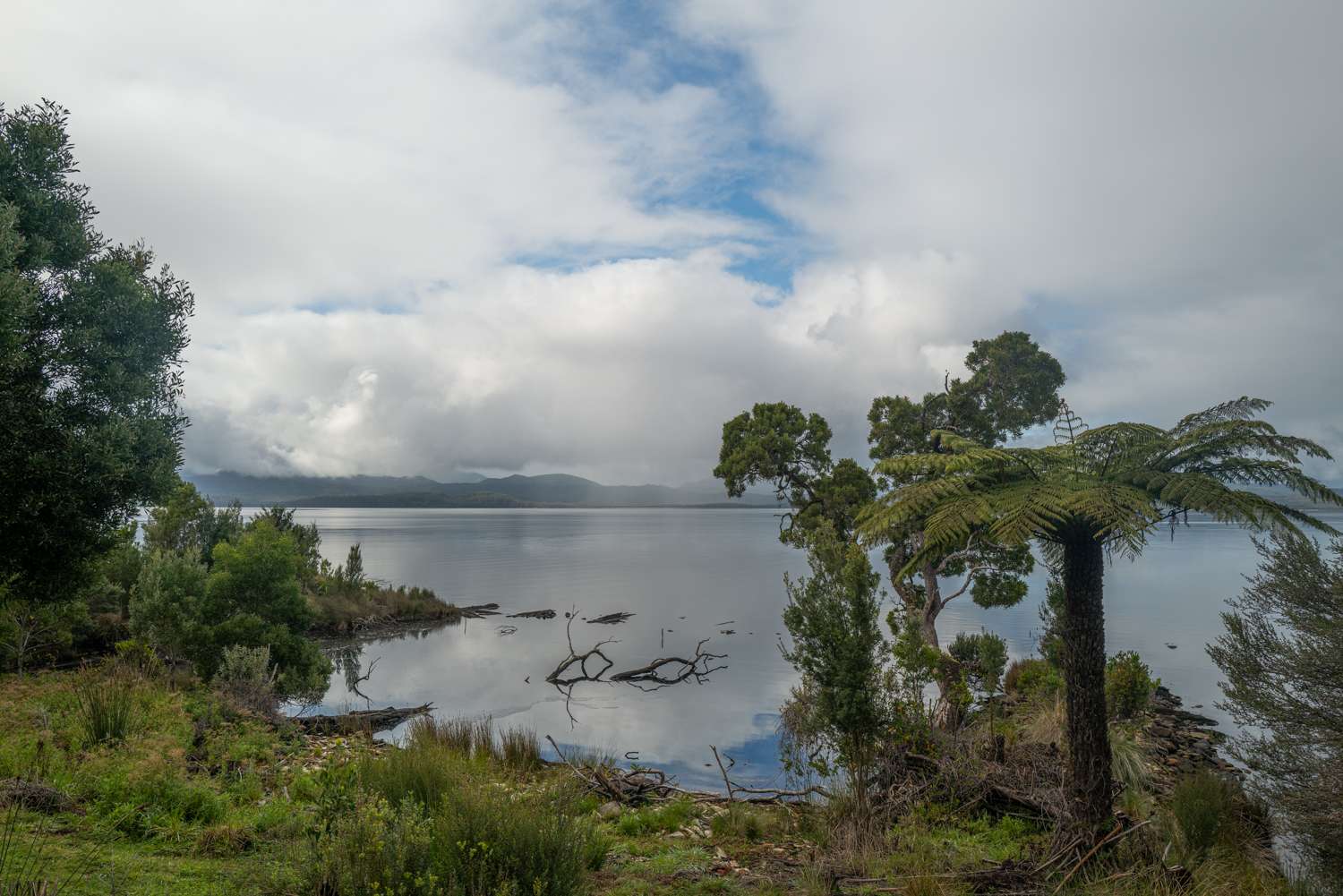
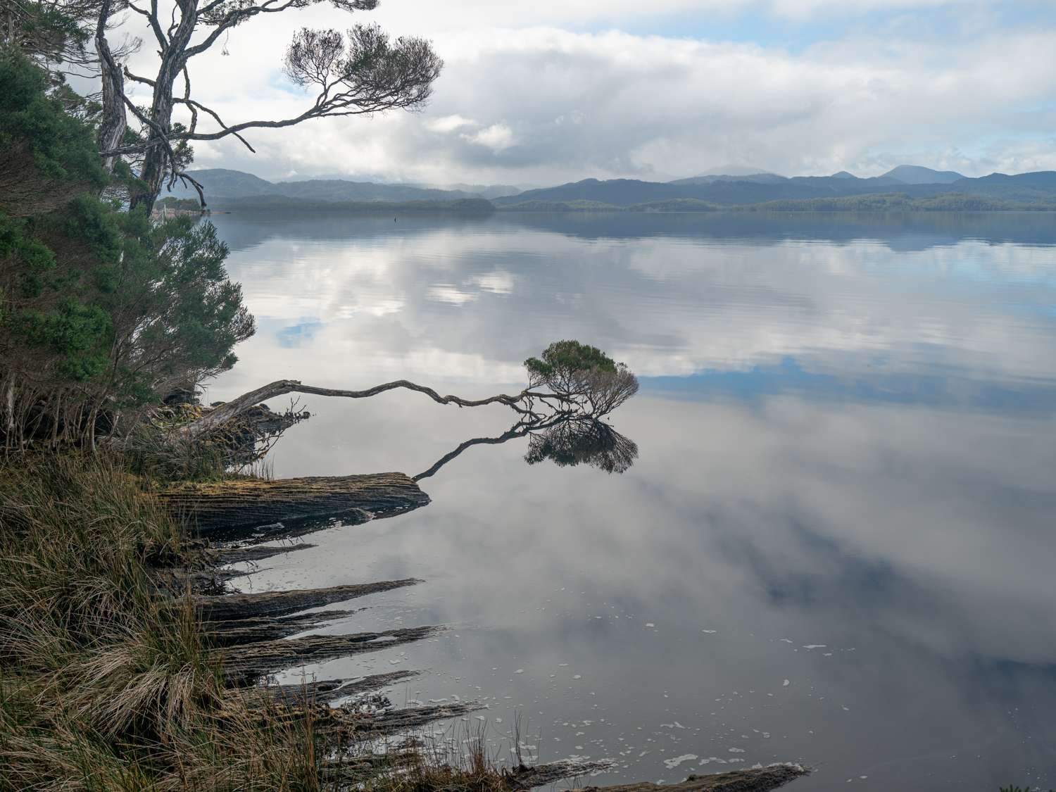
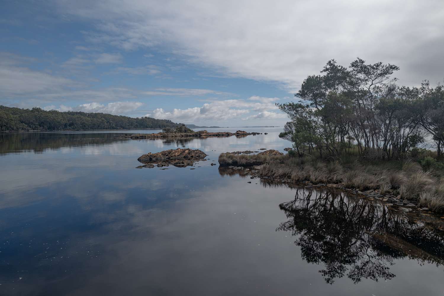
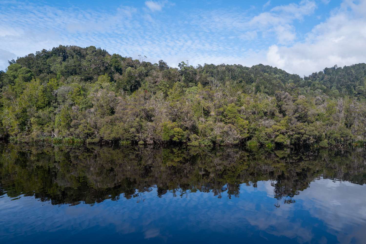
After a few days’ walking around Cradle Mountain, with only one wet day, we drove down in pouring rain to the coast and sleepy Strahan, the beautiful Macquarie Harbour and the majestic Gordon and Franklin rivers. We stayed in Strahan for four days exploring, including boating out to the notorious Hell’s Gates at the mouth of Macquarie Harbour, and also down the Gordon River.
From Strahan we drove 300 km through the spectacular World Heritage South Western Wilderness area down to Hobart on the south coast. I had high hopes that I would take some spectacular vista shots from this very winding road. What a disappointment. It rained heavily for 250 km of the drive. We were driving in low cloud until we came down from the mountains, but at least there were very few other vehicles on the road. A small consolation for a very wet, white day. It’s called rainforest for a reason.
Flight cancelled
The highlight of our stay in the south was to be a flight on a light aircraft to a dirt airstrip at Bathurst Harbour, deep in the most remote area of the South West Wilderness, for more walking. I had fond hopes of taking some original photos in this special, remote location. Not Dombrovskis standard but still good.
The flight had been booked and paid for, and we’d packed our cold and wet weather gear. Then on the afternoon of the day before we were due to depart, the phone call came — “Flight cancelled due to weather forecast! “ I pleaded, “it’s so sunny here today”. The caller, from the wilderness airline, patiently explained “That’s true, but that’s Hobart. Out there at Bathurst Harbour today it’s very low cloud, and it’s raining heavily. We have a webcam by the strip”. And he was right because the following day the clouds and rain moved into Hobart.
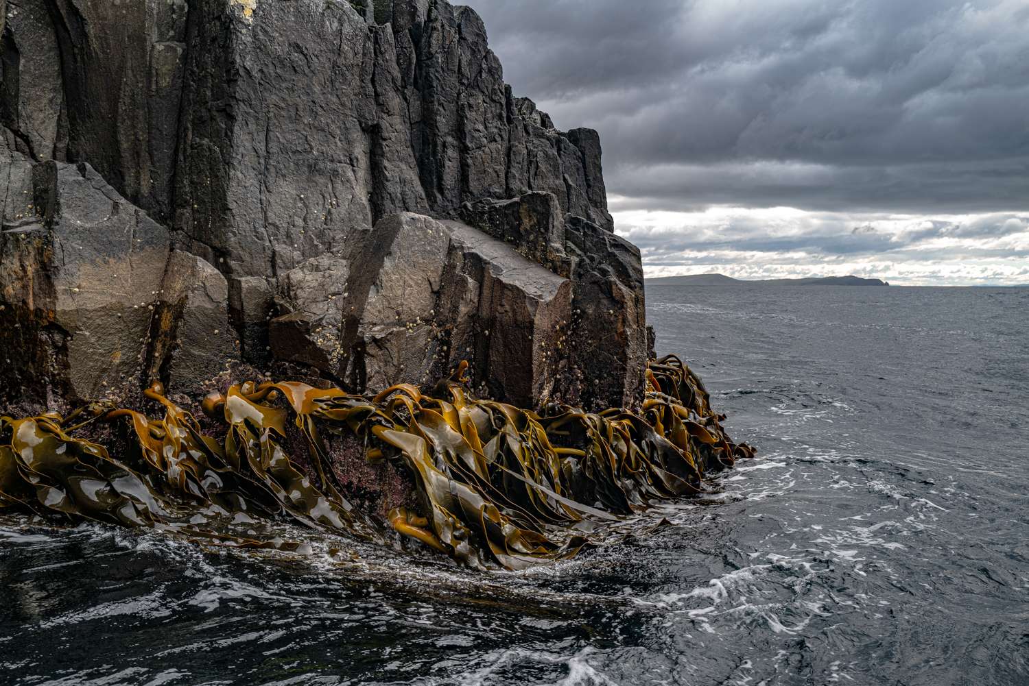
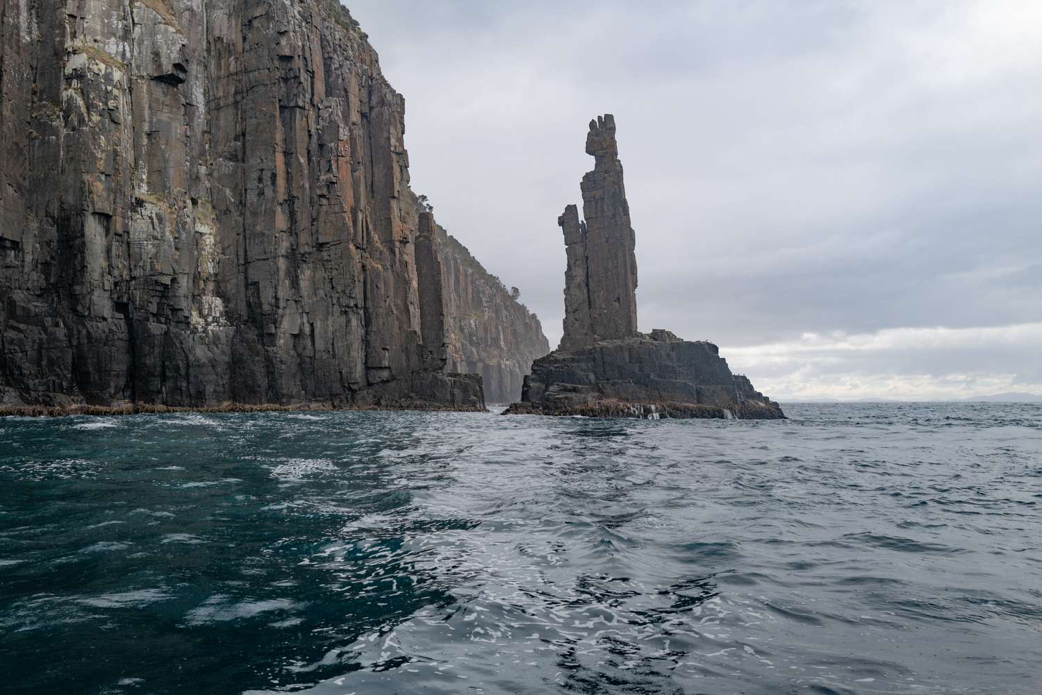
So the next day instead we went on a small boat under stormy skies along the majestic dolerite cliffs of the south coast of Bruny Island looking at seals, sea eagles, albatrosses, and crayfish (lobster) boats bobbing about in the swell.
Despite the two disappointments, the two weeks in Tasmania were a wonderful, fun trip and I came back with a few pleasing photos, a couple of which should make big prints for the house. Perhaps, as satisfying, the fitness app on my iPhone congratulated me on achieving my daily walking targets most days. A win, win.